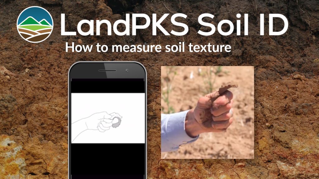
Soil texture and rock fragment content are two of the most important field properties for understanding how soils function. Together, they influence water holding capacity, infiltration, root growth, nutrient availability, and overall land use potential. Texture describes the proportion of sand, silt, and clay, while rock fragments describe the amount of material larger than 2 mm in the soil.
Enter soil texture observations on the Soil tab of the Site dashboard.
Soil texture is important for identifying soil and determining how to sustainably use the land.

Soil texture class
Soil texture is the relative proportion of different sized particles in the soil. The three sizes are:
- Sand (0.05–2 mm): gritty, large particles
- Silt (0.002–0.05 mm): smooth, flour-like
- Clay (<0.002 mm): sticky, plastic
Texture is considered a “master variable”, it influences:
- Water retention
- Drainage
- Aeration
- Soil fertility
- Erosion
In LandPKS Soil ID, soil texture is estimated using a step-by-step guided version of the Thein flow diagram. Rather than requiring users to memorize the diagram, the LandPKS Soil ID app walks you through a Guide, series of yes/no questions based on the tactile properties of the soil, helping you key out the correct texture class.
The process follows four core decision steps:
- Can you make a soil ball?
- Can you form a ribbon?
- How long is the ribbon before it breaks?
- How does the soil feel (gritty, smooth, or sticky)?
These guided questions mirror the logic of the Thein flow diagram and simplify texture determination in the field. Follow the prompts in order and answer each question based on what you feel in your soil sample.
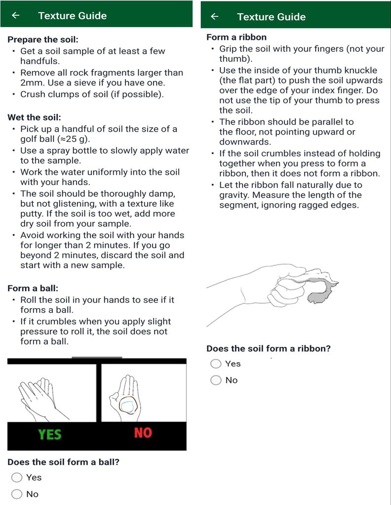
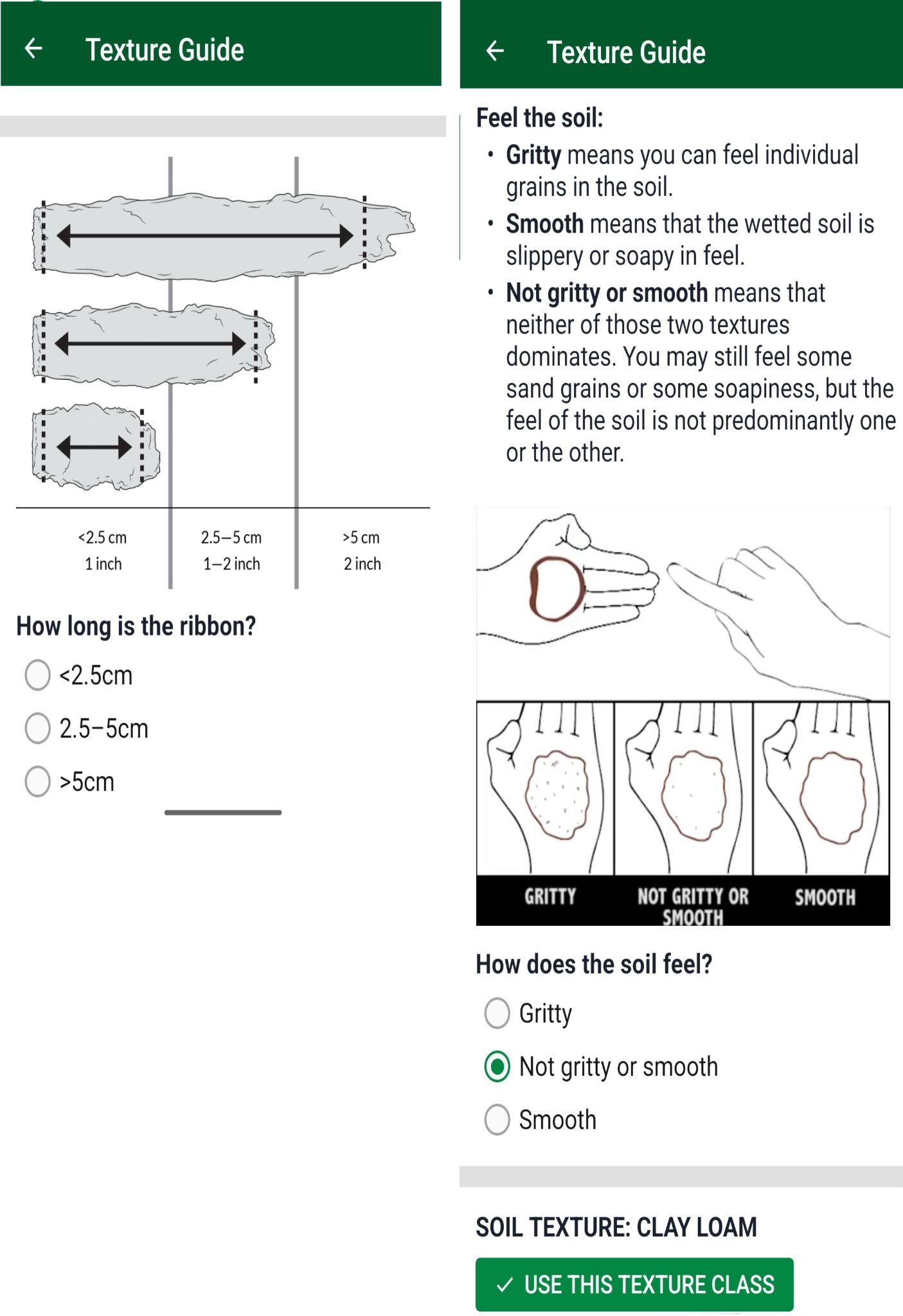
When you have completed the step-by-step guide, tap “USE THIS TEXTURE CLASS” button to add the texture observation.
Rock fragment volume
Rock fragments are particles larger than 2 mm in diameter and are classified as:
- Gravel: 2–75 mm (~up to 3 inches)
- Cobbles: 75–250 mm (~3–10 inches)
- Stones: >250 mm (>10 inches)
These fragments don’t hold water or nutrients like fine soil particles, so higher rock fragment content generally reduces soil water storage, nutrient holding capacity and productivity.
Visual estimate: compare the volume of the soil before and after removing the rocks; compare the volume of rocks removed to the volume of the remaining soil.
Sieve-aided estimate: use a 2mm sieve to separate the rock fragments from the finer soil particles. Then, perform a visual estimate of the volume, using the images in the app as a guide.
Measure and calculate: place the rocks from the sample in a bucket with a known volume of water and measure the change in volume. Then divide that volume by the volume of the original soil sample to get a percentage.
How to measure rock fragments
Step 1: Collect a representative sample
- Sample each soil horizon or depth separately.
- Don’t avoid gravel, include it in your sample.
- A 1 liter measuring cup works well. Fill to the 500 mL line with sample from the chosen horizon.
- Pour the sample into a sieve.
- Break apart soil aggregates (peds) carefully, don’t force material through the mesh.
- Separate fine earth (<2 mm) from rock fragments (>2 mm).
Step 2: Estimate percent rock fragments
- Place the separated soil back into the measuring container.
- Calculate percent by volume. For example: 400 mL soil in a 500 mL sample = 80% soil / 20% rock fragments.
Step 3: Account for large fragments
- For cobbles and stones, estimate percent of horizon volume visually.
- If large fragments occupy 20% of the horizon:
- Remaining soil = 80%
- Calculate gravel % from that remaining portion.
Step 4: Record in LandPKS Soil ID
Within the Soil tab in your site observations there are sections to record rock fragments for each horizon. Select the matching rock fragment % range that matches your finding. You will also see there are visual representations to aid in decision making in rock fragment % selection.