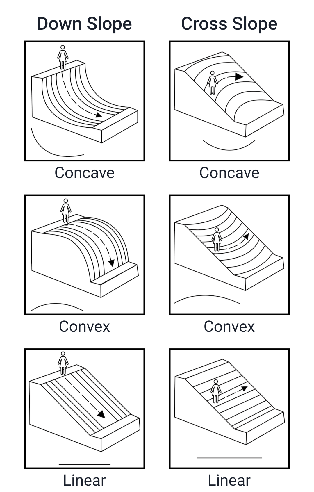
Slope shape describes how the land surface curves at your site. LandPKS Soil ID asks you to assess shape in two directions separately: across the slope (side to side) and down the slope (uphill to downhill). Thinking about how water would move across the surface is the most reliable way to identify each.
Shape across the slope
Look across the slope, perpendicular to the direction water flows downhill. Ask: would water moving across this surface spread out, stay parallel, or converge?
- Concave (hollowed): The surface curves inward like a valley or swale. Water converges toward the center.
- Linear (straight): No side-to-side curvature. Water flows in roughly parallel paths.
- Convex (rounded): The surface curves outward like a ridge or nose. Water diverges and spreads away from the center.
Shape down the slope
Now look in the direction water flows downhill. Ask: does the slope flatten out, stay constant, or steepen as water moves away from the crest?
- Concave (hollowed): The slope decreases in steepness downhill. The surface flattens toward the bottom, slowing water flow.
- Linear (straight): Consistent steepness from top to bottom with no change in gradient.
- Convex (rounded): The slope increases in steepness downhill. The surface steepens as water moves away from the crest, accelerating flow.
Select the option that best matches what you observe for each direction, then tap Done.