LandPKS News & Updates
Our Blog
SoilID redesign provides a powerful key to unlock soil information, including SoilGrids access
Since 2019, soilID, which links LandPKS users to existing soil maps of their location, has been at the core of LandPKS, and we just released a new version, available now.
Note: the Android version is currently out; the iOS version is coming soon.
“Understanding a soil’s properties and how it functions at a specific location is critical for informing sustainable land management practices. However, current sources of soil information are not accurate enough to meet that goal,” explains Jonathan Maynard, a soil scientist at the University of Colorado at Boulder who works on LandPKS and led the soilID redesign. Jonathan continues, “the value of soilID is that, through measuring a few key soil properties at a site and then linking that soil information to existing soil maps, we can minimize the uncertainty associated with those maps by identifying the most likely soil type at a location.” When users can identify their soil type, it is like handing them a key they can use to unlock a treasure trove of information about their soil and allows them to gain a better understanding of how their land will respond to different types of management.
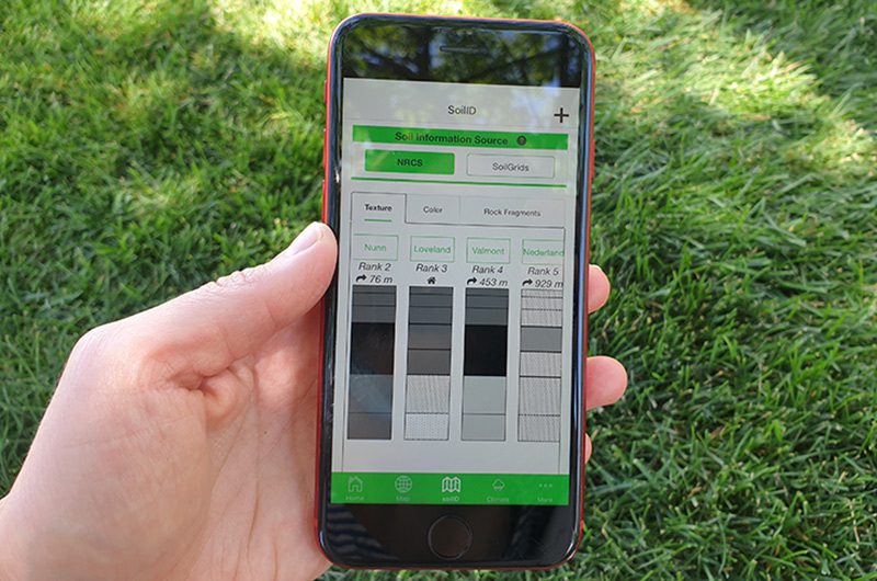
We sought to accomplish two main things with the new version of SoilID. The first was to make soil information easier for the user to interpret, through a redesign of the visual interface. The second was to provide users with additional sources of soil information to help inform decision making, including improved links to ecological site information and additional soil interpretation from SoilWeb. Recognizing recent, continuing improvements in digital soil mapping and the potential utility of those products, we now also provide a link to SoilGrids v2.0 which provides soil property predictions at a 250-meter spatial resolution.
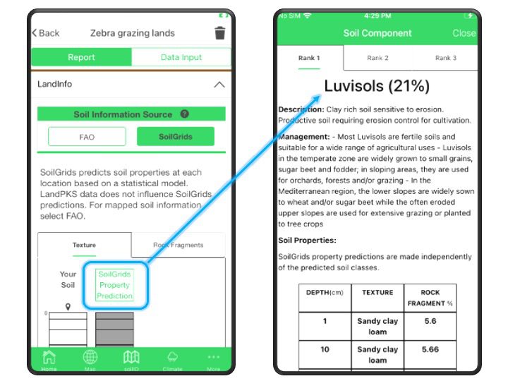
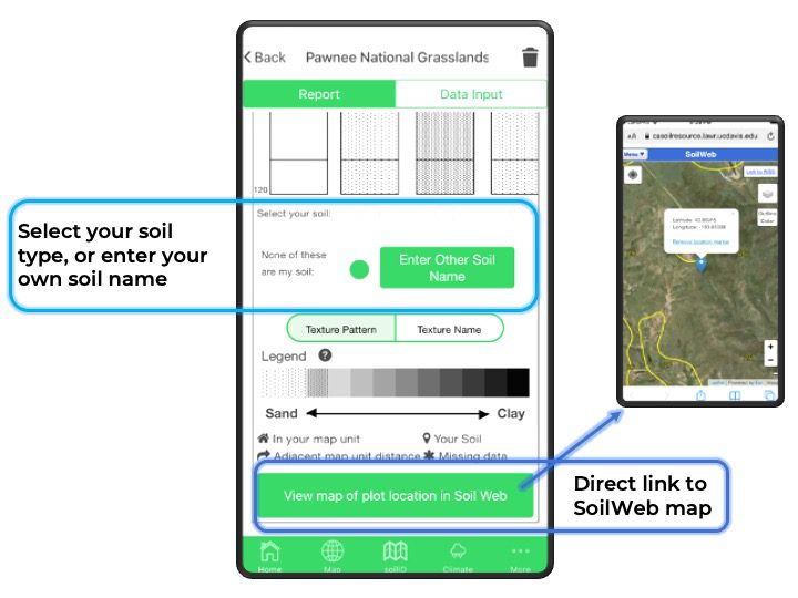
In addition, this new version of SoilID also allows users to select their soil from the list of mapped soil types, or to enter the name of a soil that is not mapped in that area. This new feature provides valuable feedback to soil mappers that can be used to help improve future updates to existing soil maps. Identifying the soil type also allows users to access more detailed soil information that is not always possible to measure in the field, including many physical and chemical properties or ecological site information.
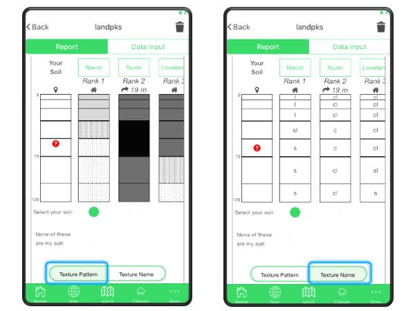
The visual redesign presented some challenges when it came to representing soil texture, one of the most important properties that influences how a soil functions. Soil texture is made up of 3 particle size classes (sand, silt, and clay), and the distribution of those 3 classes is typically represented in a pyramid, difficult to display in a linear way. Thus, when viewing soil texture profiles, it can be challenging to interpret the relative similarity of soil texture between the soil types mapped in an area.
We began the redesign process by surveying various soil scientists and other experts on different ways of displaying soil texture information. Through the survey, we were able to identify two types of users: those who wanted to see relative textures in a single legend, and those who wanted to know the individual texture classes.
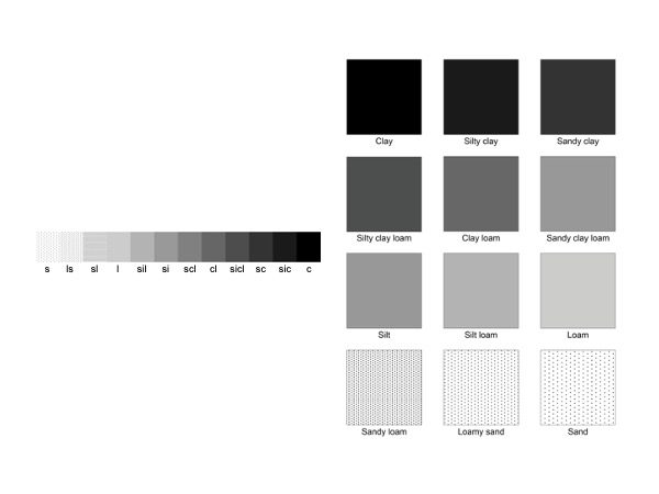
“In the new version of soilID, we display soil texture on a linear gradient based on mean particle size diameter, which allows us to visualize the soil based on the relative difference in the amount of sand versus clay,” Jonathan explains. This then relates to the general differences in soil function, such as water holding capacity or general nutrient availability. For those who want to see the individual texture classes, we provide another legend, using the texture class abbreviations.
Ultimately, Jonathan says, “the idea behind soilID is to provide the most accurate soil information at a site and to make that information interpretable to the end user.” Download the most recent version of LandPKS today and let us know what you think!
Further Reading
“Taking the Guesswork out of Soil Identification”


Jornada Experimental Range
Range Management Research Unit
2995 Knox St.
Las Cruces, NM 88003-0003, USA
Mobile App | Data Portal | Knowledge Hub | Habitat Hub | Learning Collections | Blog | About | Contact | Support