LandPKS News & Updates
Our Blog
The Role of LandPKS in Land-Use Planning
LandPKS is useful tool for improving sustainable land management for both farmers and land-use planners in Tanzania.
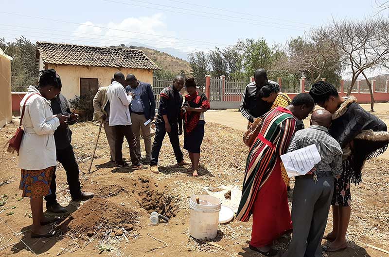
In Tanzania, the Land Potential Knowledge System has been working with the National Land Use Planning Commission as well as USAID’s Land Tenure Assistance (LTA) Project to assist in effective land use planning and land tenure efforts. LandPKS is a mobile app that helps users identify their soil, and the potential productivity and long term agricultural sustainability of that soil. By identifying areas with sustainable agricultural potential, land-use planners can integrate biophysical assessments into their participatory land-use planning process. The LTA project is helping to revise village-level land-use plans. Once land use planning is complete, LTA is using a mobile technology called MAST (Mobile Application to Secure Tenure) to assist village members to attain a CCRO (Certificate of Customary Right of Occupancy) for their farms and properties. By integrating LandPKS soil information into their land-use plans, LTA and other land-use planners can make better decisions about which areas within a village are suitable for agriculture, and which are not. Focusing agricultural growth on soils suitable for sustainable agriculture not only increases farmer revenues and productivity but saves other village lands for other, less intensive uses such as grazing areas or forest reserves.
At the national level, Dr. Stephen Nindi, Director General of the National Land Use Planning Commission, is working with the LandPKS team to implement LandPKS tools in the future for the national land-use planning process. Tanzania currently uses a 6-step process for participatory land use management, involving community members and stakeholders at every step. On the biophysical side of the land-use planning process, Tanzania draws from the seven land capabilities classes. Categorizing the land into these seven classes helps planners to determine which livelihood activities are sustainable in which areas. For example, land capability class one refers to land that is suitable for all land uses with normal land management practices, such as flat, well-drained, and fertile land. LandPKS could play a key role in helping land-use planners classify land into these seven classes based on soil texture, soil water holding capacity, potential erosion risk, and potential productivity. While soil texture is not the only important soil characteristic, it can be a critical predictor of a land’s potential and its degradation risk. Implementing LandPKS in the land use planning process will simply, and cheaply, help the National Land Use Planning Commission include more biophysical data into their land-use planning process.
Therefore, LandPKS has a role not only in improving sustainable land management for farmers and pastoralists but also on a larger scale through the land use planning process. Matching appropriate land uses to their proper soil types can increase productivity and decrease land degradation, essential goals for long-term environmental sustainability.


Jornada Experimental Range
Range Management Research Unit
2995 Knox St.
Las Cruces, NM 88003-0003, USA
Mobile App | Data Portal | Knowledge Hub | Habitat Hub | Learning Collections | Blog | About | Contact | Support