
LandPKS News & Updates
Our Blog
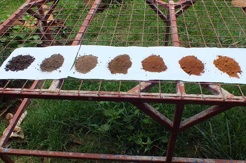
LandPKS Version 3.2 Released with Soil Color and Land Capability Classification Features
The LandInfo module walks the user through how to hand texture their soil and document other important site characteristics. Version 3.2 includes a new Soil Color function, which allows the user to determine soil color by taking a photo of the sample next to a reference card.
What’s New
- Land Capability Classification class determination
- Soil Color function to determine color
- Ability to use the soil color or texture guide without creating a site
- Updated Soil Limitations tab with new inputs
- Spanish language (change language in Settings)
The LandPKS app helps users make more sustainable land management decisions by allowing them to collect geo-located data about their soils and vegetation using several modules. It then provides users with information about their site. It also provides free cloud storage and sharing, which means that you can access your data from any computer from our Data Portal at https://landpotential.org/data-portal/ . The LandPKS app does not require a data connection to be used, and users can upload their data when they have connectivity. The LandPKS app currently includes two modules: LandInfo and LandCover.
The LandInfo module makes site and soil characterization fast and easy! The app walks the user through how to hand texture their soil, and document other important site characteristics. Version 3.2 includes the new Soil Color function, which allows the user to determine the color of their soil sample by taking a photo of the sample next to a reference card.
This version also includes the new Land Capability Classification (LCC) results in the Report page. LCC classifies the land into 8 different classes based on sustainable production potential based on Slope, Soil Texture, and Soil Limitations. This can be used for land use planning and land management.
The LandCover module is a simple tool for rapidly collecting and recording vegetation cover using a 1 meter or yard stick. The module walks a user through collecting vegetation data using a point-intercept method at 5 points at 20 locations in each plot. Cover results are automatically calculated on the phone and delivered to users as simple graphs, including cover trends over time.
Learn more about the LandPKS app on the LandPotential.org website. Training resources, including guides and online trainings, are also available on the website.
The LandPKS app was developed by USDA-ARS in collaboration with CU Boulder and NMSU with support from USAID, BLM and NRCS.


Jornada Experimental Range
Range Management Research Unit
2995 Knox St.
Las Cruces, NM 88003-0003, USA
Mobile App | Data Portal | Knowledge Hub | Habitat Hub | Learning Collections | Blog | About | Contact | Support